
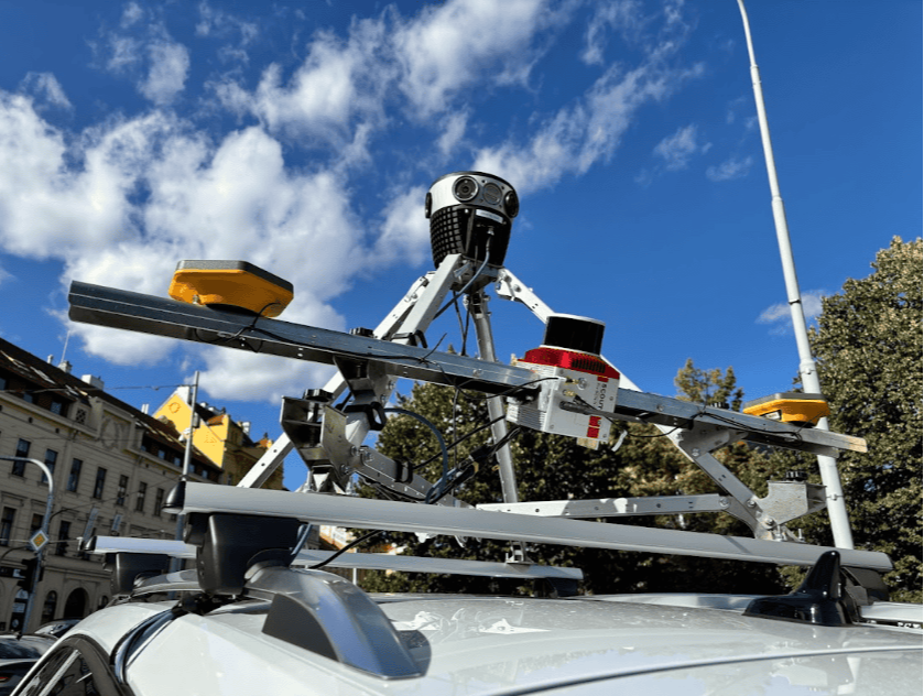
Launch of Meridian Lite Mobile Mapping System
After the success of the Meridian, our flagship mobile mapping system, the Meridian Lite promises to broaden geospatial professionals’ range of options
Mosaic is proud to announce that the Meridian Lite will be joining our lineup of high-resolution mobile mapping systems. It combines the Mosaic 51 360º camera with the Phoenix Scout-M2X LiDAR unit in one easy-to-use system.
You’ll get unmatched 360° imagery and LiDAR precision with this winning pair. The Meridian Lite provides users with an intuitive, easy-to-use LiDAR system and ultra-high-resolution 12.3K panoramic imagery. It is an ideal addition to any surveyor’s toolbelt.
The Meridian Lite’s Origins
The original Meridian is Mosaic’s flagship mobile mapping system. It integrated our Mosaic X 13.5K 360º camera with a Phoenix Scout-M2X LiDAR unit.
When we first launched the Meridian a year ago, we met the market’s need for an affordable, versatile mobile mapping solution that didn’t sacrifice quality for price.
However, after numerous successful customer case studies, we identified a market need for the Meridian Lite. This version of the Meridian has the same Phoenix Scout-M2X as the original Meridian, but this time we paired it with the Mosaic 51.
When less is more in mobile mapping
Sometimes, it is possible to have too much of a good thing. A streamlined, entry-level MMS is an affordable solution for many projects, especially with expensive data storage costs and longer rendering times associated with overly detailed imagery.
“The Mosaic Meridian Lite is a mobile laser scanner purpose-built for urban environments, capturing high-resolution panoramas and precise point clouds. It is ideal for everyday mapping, urban planning, and smart-city applications.”
-Ivan Hepp, Meridian Lite Product Owner
Overall, excessive data results in significant time wasted on post-processing. The Meridian Lite offers a high level of resolution without compromising post-processing times for most mobile mapping projects in urban environments.
Lightweight LiDAR
Most major LiDAR systems offer 1-2 million points per second, then decimate the data in order to process it. Mosaic is challenging the status quo by asking:
Why capture that much LiDAR data if it won’t make it to the finished product?
The Meridian Lite captures the point cloud data and high-resolution imagery needed for most Smart City projects, without all of the extra baggage. More data points captured means more data to process, even if it is overkill for the project. Now, you can capture and process only what you need.
Rolling shutter lenses
For example, many geospatial professionals do not require RGB projection into their LiDAR point clouds. By using a rolling shutter 360° camera, like the Mosaic 51, you can lower your investment costs compared to buying an MMS with a global shutter camera.
Choose LiDAR, imagery, or both
Another way Mosaic leads the pack is in the flexibility of our products. Both the camera and the LiDAR unit of the Meridian Lite can also operate independently. If your project only requires high-resolution street-view imagery, you can remove the LiDAR unit, and vice versa. For Smart Cities that need data capture devices that can work across multiple departments and use cases, flexibility is essential. Broaden your range of data capture services without breaking the bank!
Choose your workflow
You work best when you use familiar software and devices. That’s why the Meridian Lite is non-vendor-locked and produces non-proprietary data. Our mobile mapping systems’ data are compatible with over 20 software programs, ranging from popular name brands to niche, industry-specific programs. You own your data!